So after we cross Main, the Squajaquada resurfaces and runs along our little displaced band of Humbolt Parkway, now little more than a service road for a thruway. Still, the houses are pleasant enough and will remain so for the full length of the hike to Martin Luther King Park. Apparently some of the houses had to be moved back. In a news article from the 70s, James Pitts recalls that the house he was born in had to be jacked up and moved to make room for the expressway. The Humbolt starts curving southward here, until it becomes a north south street running to the MLK. The houses are mostly typical Buffalo two flats, big caves for the Buffalo winters. One notable exception is architect Robert Coles’ home at 321. The modern design sets it apart, and yet it does not conflict with its surroundings. I remember a pleasant summer evening in the 80s sitting in the yard of this Techbuilt house interviewing Coles about a similar struggle that he lead: to get the new university built on the waterfront.
Crossing Delavan and now walking south, the Kensington stretches out in front of you in all of its raw and dirty uniformity, which can best be viewed from the walking bridge near Northland. Southward a straight grey line stretches towards MLK beyond some far church steeples. Northward you see the twists of underpasses and overpasses where Kensington and Squajaquada interlock and where neighborhoods are even more cut off than along this strip. All of this is seen from a cage of overarching cyclone fence. Looking back just a hundred yards you see the elegant white stone, high steepled church you just passed. with its terra cotta roof. This church is for sale, another of those closed because of dwindling catholic populations as the Germans and other Catholics left the East side. It’s possible that some of their descendents might still have been here had this expressway not been built. The Parkway in the 50s was an upscale integrated neighborhood.
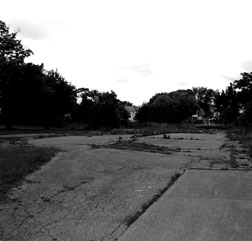
Closer, next to the church is an empty area with blacktop. A school stood here. After the Catholic school became unviable in the 70s, it became for a time one of the many homes of Cause School, and three of my children learned there in an open and experimental environment presided over by Win Evers. If the history of the independent school movement of that time ever gets written, Win should hold a special place along with the folks that ran the Independent School and at least one other. Cause eventually became incorporated into the public school system. Along with all their adventures, one horror stands out in the minds of my kids from that time. That is when a young black kid got killed by a car on the Kensington as he tried to cross to visit a friend who lived “across the street”. In the 1960s, the 50 yards to cross the Humbolt became a mile or two by the time you got to a bridge and doubled back. Sadly this kid had the habit even when he was close to the foot bridge.
Walking on, you cross Hamlin, a name that had no resonance for me as I walked, but I did have in the part of my mind that was looking back a picture of several maps that showed here the “Driving Park” which seemed to be integral to the Olmstead plan. Hamlin, according to a 1947 Buffalo News article, bought this sometime around 1868. It covered most of the area between Northland and Ferry and Humbolt and Jefferson, an area larger than MLK Park. Hamlin got rich in real estate, bred trotting horses and was instrumental in starting a circuit for that sport. With the support of many of Buffalo’s wealthiest (Schoelikopf, Albright, Lockwood and many more) he began on 80 acres here in 1888 a large exposition in an attempt to rival the Canadian National. It was a failure and disappeared after five seasons. Transportation was blamed. “A horsecar ride up Main took 52 minutes”. If only they’d had the Kensington! I’m still digging to discover the exact nature of the “Driving Park” and if it was ever public property. Some time after 1902 it was subdivided and became the “Hamlin district.”
One thing you notice with the homes, both in their present state and in the old photos: they never were as elegant or sometimes ostentatious as homes along, say, Chapin Parkway. They were typical Buffalo middle to upper middle class homes, and remain so. Smatterings of brick homes among frame two stories, big porches or sun rooms. One can imagine the pleasures of sitting on one of those porches on a summer evening and looking out across the wide parkway with its four bands of trees running the length of its middle green space. One wonders why relatively few trees now line what is left of the Parkway. Did the city not deem to plant here or were the plantings unsuccessful? It appears that such a narrow band of soil was left between sidewalk and street that the city left people to their own devices to plant on their lawns. And many did, but the former luxuriance is gone. (The Historical Society Library has photos of the Humbolt in its glory, but I haven't shelled out the money for the rights)